


▶ Wayfinding
"Cities can improve the usability of their bike networks with clear, consistent, and easy-to-follow wayfinding. Wayfinding helps people navigate unfamiliar places and along new routes. It can be especially helpful for people who are new to biking. Wayfinding is not a substitute for designing safe, comfortable bikeways." -- NACTO: Bike Route Wayfinding (excellent resource). ▶ See also: Bike Maps & Handbooks; Minimum Grid; Nine Creeks Trail - Wayfinding
Unique Wayfinding Considerations for Cycling
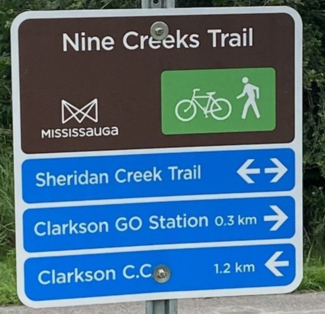
Wayfinding from the seat of a bike is a different experience from walking or driving. Signage and road markings need to be visible from that vantage point, and quickly understandable when moving up to 20km/hr on a variety of terrains: from road-based bike lanes to shared (multi-use) boulevard trails to possibly unpaved park trails or off-road trails. While advisable to travel with a bike map, it can never be up to date or reflect actual conditions. Wayfinding for cyclists should feature intuitive symbols and minimal wording in a consistent format for clarity at a glance. Marked detours in work zones also need to reflect the needs of people on bikes, including protection from motor vehicles.
Improving signs and maps in Downtown Mississauga
[Posted: September 8, 2025]
The City of Mississauga is testing new wayfinding resources (directional signs and maps) in Downtown Mississauga from June to October 2025. This is to make navigating downtown easier for everyone, including people who walk, cycle, ride micro-mobility vehicles and drive. See: City Project webpage.
What is wayfinding? City definition: "Wayfinding is a system of signs, maps, landmarks and environmental features that help people to navigate their way in a space with confidence. These cues guide people through public places like transit stations, hospitals, and schools. They also make it easier for people to discover cultural attractions, local shops, and businesses."
PARTICIPATE: "Take our quick SURVEY and tell us what helps you navigate — and what doesn't." Open until Tuesday, September 30, 2025 (See X posting in sidebar).
▶ Topical MCN! X Posts:
WAYFINDING DOWNTOWN: *SURVEY* Until Tues Sept 30. "Whether you walk 🚶♀️ bike 🚴♂️ roll 🛴 or drive 🚗 we want to hear from YOU! ... Your input will help shape the future of #wayfinding" in downtown #Mississauga 🔗: https://t.co/LDmQxQ5Z8F | #bikeMississauga 🚲 pic.twitter.com/0ohhHuPNqL
— Mississauga Cycling Now! (@MissCyclingNow) September 8, 2025
NAMING CITY ASSETS: *TONIGHT* Thurs Nov 2 @ 6-8pm. In-person/virtual 💻👥️️💬 meeting. 👉🏼ADVOCATE re: Park trails + Off-road trails - These #cycling routes are key for #wayfinding but often just numbered internally. Info +Reg'n 🔗: https://t.co/tFXE3o6A45 | #bikeMississauga 🚲 https://t.co/ncGnJKJ81M
— Mississauga Cycling Now! (@MissCyclingNow) November 2, 2023
TRAIL SIGNAGE PILOT: Sample etiquette signs are installed at entrances to Lake Aquitaine & Wabukayne path systems. City AT Dept has *SURVEY* 🖥️💬 to comment on icons 🐢🛎️ and messaging. Better ideas?💡🔗: https://t.co/Tlk0NeXQkG #ShareTheTrail 🚴🏾♂️ 👩🏾🦽🚶🏻♀️🤸🏽♀️🛴🐕 #bikeMississauga 🚲 https://t.co/T0JnrbaPwX pic.twitter.com/VK7QtG4Adv
— Mississauga Cycling Now! (@MissCyclingNow) June 5, 2021
Copyright © 2025 MCN! - Mississauga Cycling Now! All Rights Reserved.